
Walking the Inglewood Street Directory by Address
A useful street directory starts with geography. Enter one full situs address into the Los Angeles County Assessor Portal. If the form misses, remove the unit detail, try the street spelling used by the county, or move to Map Search and use a nearby cross street. Capture the AIN and parcel outline before looking for any name. The public result can show the property location, characteristics, values, map reference, and sale-related fields, but the web card does not display the owner.
From there, the address trail uses different record questions. A map shows adjacent parcels; OpenGov shows projects; the Assessor’s authorized offline route can identify an assessed owner and mailing destination; the RR/CC index then uses party and year; Haines and older directories add dated listings.
- Address. Normalize the street form and record the result exactly as entered.
- AIN. Capture the Assessor Identification Number, situs, tract or lot reference, and nearby parcel numbers.
- Adjacent parcels and GIS. Use county and city maps to inspect shared-boundary and across-street parcels.
- Lawful offline owner route. Use an authorized county access channel when an assessed owner or mailing destination is needed.
- Deed party and year. Take the named party and likely recording year to the Norwalk grantor/grantee index.
- Voter-file limit. Treat California My Voter Status as a self-check; a street filter requires a qualified-purpose application under Elections Code section 2194.
- Haines. Ask the library for its three area reverse directories and read the numbered street section at the edition date.
The result is a street worksheet that can be checked and corrected. It is more reliable than a single search result that treats ownership as occupancy.
Note: The worksheet keeps parcel geography and named-record evidence separate, so an address clue does not silently become an occupancy claim.
Inglewood Street Directory Records
Some records begin with an address. Others only become address-useful after a parcel or person is known. The Assessor accepts address or AIN. The map viewer lets a researcher click adjoining polygons. OpenGov accepts a project address or parcel number. Haines starts from address or telephone number. The recorder’s deed index does not accept an address, and the ordinary public cannot browse voter names by street.
| Source | Street question | Access | Caveat |
|---|---|---|---|
| Assessor Portal | Which parcel matches this address? | Address or AIN web search | Owner suppressed online |
| Assessor Map Search | Which parcels touch or face it? | Free parcel-map browse | Parcel boundary is not a household |
| RR/CC deed index | Who conveyed title and when? | Norwalk grantor/grantee/year volumes | No web or address index |
| OpenGov permits | What work was tied to the address? | Address or parcel project search | Applicant is not proof of occupancy |
| Haines directory | Who was listed at an address? | Three area editions at the library | Edition years need confirmation |
| Qualified voter file | Which registration records may be released? | Purpose-based application | No public block browse |
Use the address-record table as a routing chart. Current ownership and historical occupancy are separate tasks, and the full one-person method belongs on the Inglewood resident lookup page rather than inside every street row.
Inglewood Street Directory: Address to AIN
The AIN is the stable county key when an address is written in several ways. A corner parcel may carry a different situs form from a mailing label. A multi-unit or commercial property can return a parent parcel or a result that needs map confirmation. The Assessor suggests trying a nearby cross street or using the map when the address does not match. Capture every variant before moving to deeds or permits.
The public portal’s useful fields are narrow by design. They locate the parcel and describe assessment data. They do not make the public website an owner-name search. Mailing address, if available through a lawful county channel, can differ from situs and may point to a trust, manager, family address, or other notice destination. It is never a complete resident list.
| Field label | Type | Required | Options / format notes |
|---|---|---|---|
| Search by AIN or Address | Text/autocomplete | Yes | Enter AIN or situs street address. |
| Map Search | Tab/mode | No | Browse parcel geography and adjacent AINs. |
| Assessor Internet | Tab/link | No | Assessor service gateway. |
| Owner name | Unavailable online | Not applicable | Use an office or authorized data channel. |
| ZIP | Not standalone | Not applicable | May display on situs; no ZIP-wide resident filter. |
Four terms keep an Inglewood street directory address trail precise:
- Parcel
- A mapped piece of land tied to an AIN. It is a property unit, not a household.
- Situs address
- The physical assessment location, which can differ from a mailing address.
- Plat
- A recorded map that translates street lines into tract, lot, and block descriptions.
- Criss-cross directory
- An address-first or telephone-first directory showing a listed subscriber at the edition date, not every occupant.
Open the Los Angeles County Assessor Portal to compare the address and AIN search before carrying the result into the street records trail.
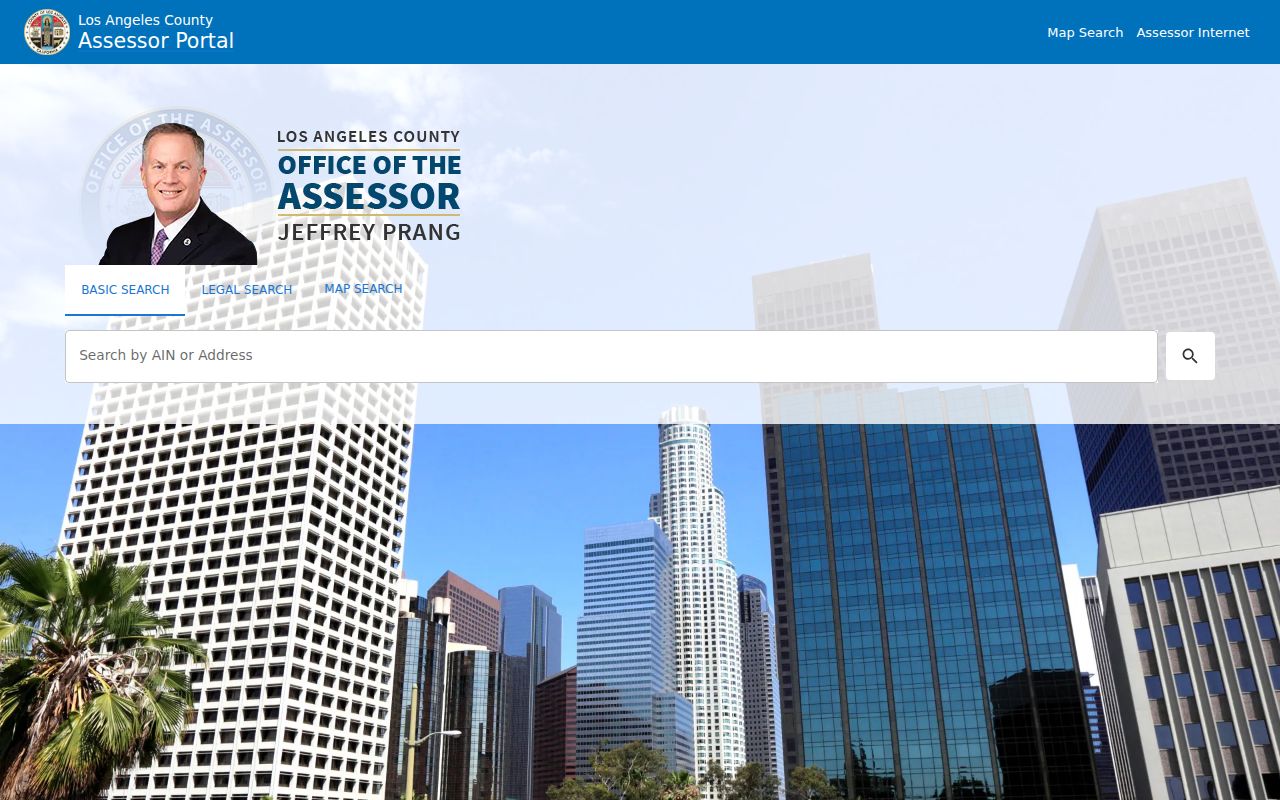
The Assessor screenshot illustrates the address-to-parcel first step, not an owner-name result.
Why Inglewood Owner Names Leave the Web
Los Angeles County separates parcel lookup from owner lookup. The Assessor public portal accepts an AIN or situs address but omits owner names. Owner information may be available at a district office or through Property Data Sales. The RR/CC recorder index is also not published online because protected officials’ home addresses can appear in recorded documents.
This makes the address search a two-stage process. Establish the parcel first, use an authorized office route for an assessed owner if needed, then take the name and likely year to the Norwalk party index. The alphabetic grantor/grantee volumes have no telephone search service, so each step has a defined custodian.
Do not replace the missing web name with a guess from a permit, mailing label, or commercial compilation. Those clues can be dated and useful, but the official record must be verified at the source.
Note: An assessed owner, mailing address, permit applicant, and occupant are separate labels with different custodians.
Inglewood Street Directory: Parcel Maps
The Assessor Map Search is the best current way to see a block as parcels rather than as an undifferentiated street. Search the target address or AIN, zoom until the outlines are readable, click the target to confirm its AIN, then click each shared-boundary and across-street polygon. Keep the AIN and situs for each parcel. Names should wait for a lawful offline step, if one is needed at all.
City GIS can add council districts, ZIP boundaries, zoning, and municipal layers. The county parcel data remains the key assessment identity. Inglewood’s December 2025 ZIP map is particularly useful at city edges, but map terms control reuse. A custom GIS request can carry a quoted cost, and the city describes itself as the sole proprietor of its map data.
Open the Inglewood GIS Request form to review the city route for custom map work and analysis before using the image as a parcel-context reference.
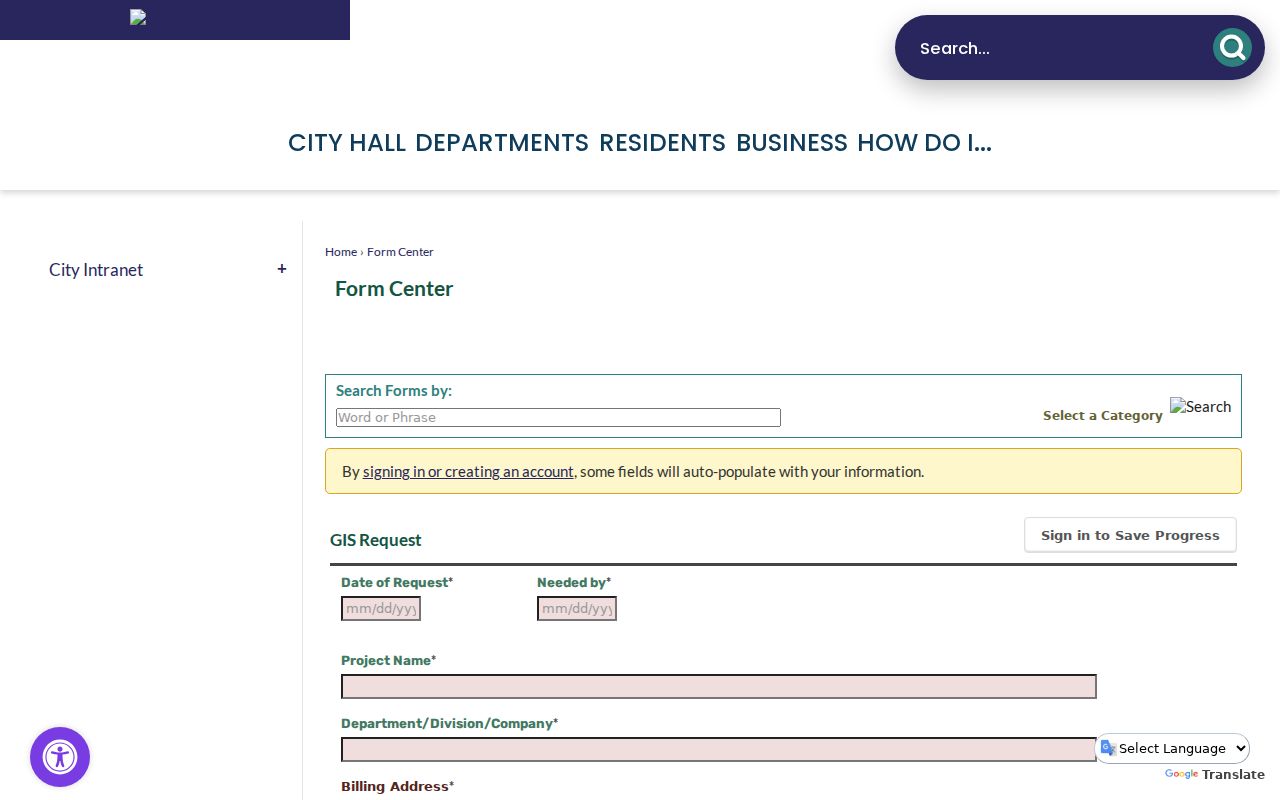
The GIS request screenshot belongs beside parcel and jurisdiction work, while an assessed owner remains a separate county access question.
Inglewood Street Directory: Deed Chains
Once a named owner and likely year are available through an authorized channel, the recorder’s party index can reveal the recorded trail. Search the owner as grantee, meaning the party receiving an interest, in the expected acquisition year. Note the document number, then read the deed for grantor, grantee, vesting, legal description, recording date, and referenced instruments. Search the seller as an earlier grantee and repeat backward.
The recorder covers real-estate records from 1851 forward. Older index material from 1851 through 1957 is reviewed on the lower level in Norwalk; 1958 to the present is on the second floor. The public can inspect the index by appointment, but staff do not perform telephone searches. Copies can be requested through the online recorded-document request, by mail, or in person after the instrument is identified.
A deed proves a recorded property relationship. It does not show every person who lived at the situs. Use Haines, city directories, census schedules, and address-keyed permits to add historical occupants, and label each fact with its source date. A grantor or grantee can be a trust, lender, corporation, or family member.
Record the legal description as carefully as the street form. Tract, lot, and block language can keep the chain together when an address, ZIP, or parcel representation changes.
Note: A deed chain follows recorded interests backward; Haines and census records are needed for selected household clues.
Inglewood Street Directory: Haines Reads Addresses
Inglewood Public Library confirms three Haines reverse directories covering areas around Inglewood. Haines is a criss-cross source: a known street address or telephone number leads to a listed subscriber at the edition date. Staff should be asked for the exact volumes and current service because the public FAQ does not publish the year run. That gap is useful to state plainly rather than fill with an invented date.
Read the street section in number order and copy the entries immediately before and after the target. Then use the alphabetical half to check surname and initials. A listing can capture one subscriber while missing other household members. Older volumes may have abbreviations for home, residence, rooming, spouse, or business. The volume’s key controls the meaning.
The confirmed 1929 Inglewood city directory supplies a second angle. Its entries show names, spouse or widow notation, occupations, and house addresses. A 1929 listing can be paired with the 1930 census, while a nearby directory edition can narrow a move interval. For the full historical shelf, use the Inglewood city directory collections; Haines remains the address-first tool.
Permits Add Inglewood Address Evidence
Inglewood Building Safety’s OpenGov instructions direct a researcher to search a project address or parcel number, choose a match, and inspect available details. A file can connect an applicant, contractor, owner or agent, description, valuation, issue status, and inspection events to a place.
A permit is not a resident record. An applicant may be a firm, contractor, agent, or prior owner, and an issue date does not prove occupancy. Request older files from Building Safety with the address, AIN, project type, and date range. Code Enforcement can identify releasable closed cases, while open investigations and complainant information may be withheld.
Used beside the AIN and deed chain, permit history can explain an addition, conversion, or repair without overstating what the record says about people.
Note: Permit parties date work at a place, but the file does not establish title or who lived there.
When 90304 Is Not Incorporated Inglewood
Postal geography and city jurisdiction do not line up at every edge. The city’s December 2025 ZIP map shows postal polygons with incorporated and neighboring boundaries. ZIP 90304 reaches the southwest Inglewood and Lennox-edge postal area, and a mailing address that says Inglewood can fall in unincorporated Lennox. In that case, a city permit request may be sent to the wrong custodian even though the envelope uses the Inglewood postal name.
Check the city or county GIS line before requesting a permit, code case, or local administrative record. The same caution applies to North Inglewood, where Los Angeles and Ladera Heights or View Park-Windsor Hills geography meets the city. A ZIP can group addresses for mail; it cannot decide which government issues a permit.
Keep postal ZIP, situs city, jurisdiction, and AIN in separate fields. This small detail makes address work at a boundary possible without merging records from two places.
What an Inglewood Street Directory Cannot Show
No public source lists everyone who lives on an Inglewood street. Deeds identify recorded interests, not all occupants. The Assessor web portal suppresses owners. Voter data is either a self-check or a restricted file for approved purposes. DMV addresses are closed under the Driver’s Privacy Protection Act, utility customer lists are not public directories, and protected Safe at Home addresses are shielded.
Address research can still support lawful family history, property curiosity, civic research, or a check of an official filing. It should not be used to track a living person, expose a protected address, or treat a stale subscriber listing as current fact. When a record conflicts, compare dates and identifiers, then ask the custodian about correction or copy procedure.
For an existing city record, use the Inglewood City Clerk request channel; the CPRA does not require a new list. Keep the named-street address trail separate from neighbor and historical workflows.
Note: A protected or missing result may reflect an access rule, not evidence that no related record ever existed.
Bridging Older Inglewood Street Numbers
Old address work needs more than autocomplete. The February 1912 Inglewood Sanborn set contains 13 sheets showing street names, building footprints, uses, and early numbering. The 1929 directory adds local tokens such as Centinela, Arbor Vitae, Buckthorn, Eucalyptus, Grevillea, Market, Nutwood, Regent, and Spruce. Compare cross streets, the current parcel map, and the legal description before joining two numbers.
No verified citywide street-renumbering ordinance or single readdressing year appears in the research. Carry the historic and current street forms, AIN, tract or lot and block, map sheet, and source date. Public Works, GIS, or Engineering answers incorporated-parcel addressing questions at 310-412-5333; an adjoining unincorporated parcel may route elsewhere.
The Library of Congress Sanborn item is a free historical bridge. It shows the built landscape, while deeds show recorded interests and directories show selected people.